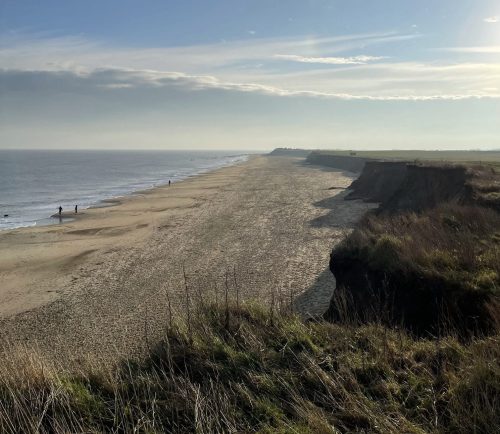
The Palaeolithic story at Happisburgh has changed over the last twenty years or so, much as the coastline itself has changed dramatically over the same time. Indeed, the Happisburgh handaxe was discovered in situ in deposits that were revealed by the retreating cliffs between Happisburgh and Cart Gap. The exposures of the Cromer-Forest-bed Formation that were visible in 2000 when the handaxe was found are occasionally still to be seen, though much degraded by the passage of time and tides. These deposits have been the subject of detailed archaeological investigations which have placed the Happisburgh handaxe into a secure, geological, environmental and archaeological context, within a series of sediments deposited in an abandoned river channel during a period of temperate climate. The handaxe is now one component of an assemblage of Lower Palaeolithic artefacts that indicate human presence in this area around 500,000 years ago.
This is not the only evidence of human presence in Happisburgh’s distant past. A few hundred metres along the coast to the northwest, lies another set of Cromer Forest-bed Formation sediments. These have also been studied in detail and the resulting assemblage of Lower Palaeolithic artefacts, together with vertebrate remains, pollen, plant macrofossils and beetles, provides evidence for the landscape and environment that the first humans to reach Britain encountered. Exposures of these sediments on the foreshore also revealed human footprints, providing a brief glimpse of family life over 800,000 years ago.

As the waves continue to pummel the coastline, scouring of the beach has severely eroded these archaeologically-important sediments. A large number of artefacts and fossils have been released onto the beach to be found by a growing number of eagle-eyed collectors who have been busy over the last few years. These are more than ‘coastal curios’, they add to Happisburgh’s Palaeolithic record, particularly when the find-location is accurately recorded, as demonstrated in the recent paper by PAB researcher Dr Rachel Bynoe, which analysed the material amassed by three of the collectors.
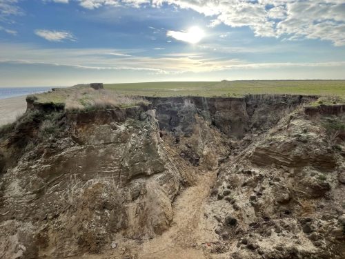
Happisburgh’s coastline continues to undergo changes. Some of the 1.8 million cubic metres of dredged material emplaced between Bacton and Walcott for the Sandscaping project completed in 2019 has been moved along the coast by longshore drift to reach Happisburgh, so that in early 2022 the beaches at Happisburgh are beautiful stretches of golden sand, and what remains of the archaeological deposits are again hidden and protected from the waves. This has also introduced a new component to the archaeological record in this area. Retreat of the cliffs continues; in early 2021 a remarkable feature formed to the south of Happisburgh when, after several days of heavy rainfall, erosion of the unconsolidated sands that form the cliffs resulted in localised collapse. The feature may have started to form in late 2020 when the early stages of cliff collapse at the location were reported on social and news media. It has continued to develop and enlarge so that in early 2022 it is some 40m across and extends about 20m back from the adjacent cliff edge and it has developed into a dendritic or ‘tree-shaped feature’ in the cliff, with drone footage clearly capturing the extent of the erosion. A nearby pillbox also stands perilously close to the cliff edge and its days as a landmark on the Happisburgh cliff-top are surely numbered.

